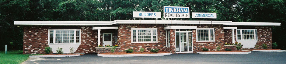
Tinkham Realty, Inc.
3 McAllister Drive
Londonderry, NH 03053
(603) 432-7769
(603) 434-1545 Fax
info@tinkhamrealty.com
|
Bedford, NH Town Profile
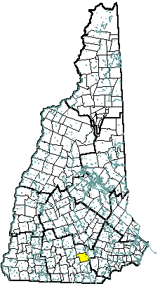 |
| Bedford, NH |
| Community Contact |
Town of Bedford
Rick Sawyer, Planning Director
24 North Amherst Road
Bedford, NH 03110
|
| Telephone |
(603) 472-5242 |
| Fax |
(603) 472-4573 |
| E-mail |
rsawyer@ci.bedford.nh.us |
| Web Site |
www.bedfordnh.org
|
| Municipal Office Hours |
Monday through Friday, 8 am - 4:30 pm
|
| County |
Hillsborough |
| Labor Market Area |
Manchester NH Metro-NECTA |
| Tourism Region |
Merrimack Valley |
| Planning Commission |
Southern NH |
| Regional Development |
Southeast Economic Development Corp.
|
| Election Districts |
|
|
US Congress
|
District 1 |
|
Executive Council
|
District 4 |
|
State Senate
|
District 9 |
|
State Representative
|
Hillsborough County District 18 |
|
Incorporated: 1750
|
Origin: Bedford was established in 1730 as Narragansett Number 5 for the benefit of soldiers who fought against the Narragansett Indians in Rhode Island. Twenty years later little had been done to the land, and it was regranted first as Souhegan East, then as Bedford in 1750. The town was named for Lord John Russell, fourth Duke of Bedford, a close friend of Governor Benning Wentworth, whose first wife, Diana Spencer, was cousin to the Duke of Marlborough. The town's first moderator was Major John Goffe, son of Colonel John Goffe for whom Goffstown was named.
|
Villages and Place Names: unknown
|
Population, Year of the First Census Taken: 898 residents in 1790
|
Population Trends: Bedford ranked ninth in percent change and eighth in numeric change over 50 years. Population change totaled 16,316, from 2,176 in 1950 to 18,492 in 2000. The largest decennial percent change was 67 percent between 1950 and 1960. The 2006 Census estimate for Bedford was 20,986 residents, which ranked 12th among New Hampshire's incorporated cities and towns.
|
Population Density, 2006: 640.8 persons per square mile of land area. Bedford contains 32.8 square miles of land area and 0.3 square miles of inland water area.
|
| Type of Government |
Manager & Council |
| Budget: Municipal Appropriations, 2006 |
$23,022,751 |
| Budget: School Appropriations, 2006 |
$56,262,441 |
| Zoning Ordinance |
1953/07 |
| Master Plan |
2000 |
| Capitol Improvement Plan |
Yes |
| Industrial Plans Reviewed By |
Planning Board |
| Boards and Commissions |
|
Elected:
|
Town Council; Library |
|
Appointed:
|
Planning; Zoning; Conservation; Historic District |
| Public Library |
Bedford Public |
| Police Department |
Full-time |
| Fire Department |
Full-time |
| Town Fire Insurance Rating |
5/9 |
| Emergency Medical Service |
Municipal |
| Nearest Hospital(s) |
Distance |
Staffed Beds |
| Elliot Hospital, Manchester |
6 miles |
296 |
| Catholic Medical Center, Manchester |
4 miles |
330 |
| |
|
|
| Electric Supplier |
PSNH |
| Natural Gas Supplier |
KeySpan |
| Water Supplier |
Manchester Water Works; Pennichuck Water Works |
| Sanitation |
Private septic & Municipal |
| Municipal Wastewater Treatment Plant |
No |
| Solid Waste Disposal |
|
|
Curbside Trash Pickup
|
None |
|
Pay-As-You-Throw Program
|
No |
|
Recycling
|
Voluntary |
| Telephone Company |
Verizon |
| Cellular Telephone Access |
Yes |
| Cable Television Access |
Yes |
| Public Access Television Station |
Yes |
| High Speed Internet Service: |
|
|
Business
|
Yes |
|
Residential
|
Yes |
|
|
| 2006 Total Tax Rate (per $1000 of value) |
$16.34 |
| 2006 Equalization Ratio |
87.5 |
| 2006 Full Value Tax Rate (per $1000 of value) |
$14.29 |
| 2006 Percent of Local Assessed Value by Property Type |
|
Residential Land and Buildings
|
82.9% |
|
Commercial Land and Buildings
|
16.0% |
|
Public Utilities, Current Use, and Other
|
1.0% |
|
|
| 2006 Total Housing Units |
7,668 |
| |
|
| 2006 Single-Family Units |
6,295 |
|
Single-Family Permits Issued, Net Change of Units
|
53 |
| 2006 Multi-Family Units |
1,372 |
|
Multi-Family Permits Issued, Net Change of Units
|
83 |
| 2006 Manufactured Housing Units |
0 |
|
|
 |
|
|
|
| Total Population |
Community |
County |
| 2006 |
20,986 |
402,789 |
| 2000 |
18,492 |
382,384 |
| 1990 |
12,513 |
336,549 |
| 1980 |
9,481 |
276,608 |
| 1970 |
5,859 |
223,941 |
| Census 2000 Demographics |
| Population by Gender |
|
Male
|
8,988 |
Female
|
9,286 |
| Population by Age Group |
|
Under age 5
|
1,329 |
|
Age 5 to 19
|
4,212 |
|
Age 20 to 34
|
2,190 |
|
Age 35 to 54
|
6,703 |
|
Age 55 to 64
|
1,737 |
|
Age 65 and over
|
2,103 |
|
Median Age
|
39.2 years |
| Educational Attainment, population 25 years and over |
|
High school graduate or higher
|
92.6% |
|
Bachelor's degree or higher
|
49.3% |
|
|
| Per capita income |
$37,730 |
| Median 4-person family income |
$91,868 |
| Median household income |
$84,392 |
| Median Earnings, full-time, year-round workers |
|
Male
|
$69,987 |
|
Female
|
$39,507 |
| Families below the poverty level |
1.6% |
|
|
| Annual Average |
1996 |
2006 |
|
Civilian Labor Force
|
7,973 |
11,170 |
|
Employed
|
7,804 |
10,862 |
|
Unemployed
|
169 |
308 |
|
Unemployment Rate
|
2.1% |
2.8% |
|
|
| Annual Average Covered Employment |
1996 |
2006 |
| Goods Producing Industries |
|
|
|
Average Employment
|
941 |
1,272 |
|
Average Weekly Wage
|
$653 |
$1,220 |
| |
|
|
| Service Providing Industries |
|
|
|
Average Employment
|
9,959 |
11,657 |
|
Average Weekly Wage
|
$598 |
$902 |
| |
|
|
| Total Private Industry |
|
|
|
Average Employment
|
10,900 |
12,929 |
|
Average Weekly Wage
|
$602 |
$933 |
| |
|
|
| Government (Federal, State, and Local) |
|
|
|
Average Employment
|
531 |
829 |
|
Average Weekly Wage
|
$574 |
$771 |
| |
|
|
| Total, Private plus Government |
|
|
|
Average Employment
|
11,431 |
13,758 |
|
Average Weekly Wage
|
$601 |
$924 |
| n = indicates that the data does not meet disclosure standards |
|
| Schools students attend: |
Bedford operates grades K-8; grades 9-12 are tuitioned to Manchester West |
District: SAU 25 |
| Career Technology Center(s): |
Manchester School of Technology |
Region: 15 |
|
| |
| Educational Facilities |
Elementary |
Middle/Junior High |
High School |
Private/Parochial |
|
Number of Schools
|
3 |
1 |
|
1 |
|
Grade Levels
|
P K 1-5 |
6-8 |
|
K 1-12 |
|
Total Enrollment
|
2,049 |
1,016 |
|
148 |
|
| NH Licensed Child Care Facilities, 2007: |
Total Facilities: 29 |
Total Capacity: 1,880 |
|
| Nearest Community/Technical College: Manchester |
| Nearest Colleges or Universities: St. Anselm; Southern NH University; Hesser; UNH-Manchester |
|
| Wal-Mart |
Department store |
283 |
|
| Bedford School District |
Education |
245 |
|
| Macy's |
Retail |
199 |
|
| Lowe's |
Home improvement center |
196 |
|
| Wayfarer/Quality Inn |
Hotel, restaurant, convention center |
185 |
|
| Kelly Services |
Temporary employment agency |
150 |
|
| Target |
Retail |
150 |
|
| Graham Packaging |
Research & manufacturing of plastic bottles |
100 |
|
| Harvey Construction |
Construction |
100 |
|
| |
|
|
|
| Road Access |
US Routes |
3 |
| |
State Routes |
101, 114 |
| Nearest Interstate, Exit |
I-293, Exit 3 |
| |
Distance |
Local access |
| Railroad |
Boston & Maine |
| Public Transportation |
Yes |
| |
| Nearest Public Use Airport, General Aviation |
|
Manchester-Boston Regional
|
|
Runway
|
9,250 ft. asphalt |
|
Lighted?
|
Yes |
Navigational Aids? |
Yes |
| Nearest Airport with Scheduled Service |
| Manchester-Boston Regional |
Distance |
7 miles |
| Number of Passsenger Airlines Serving Airport |
8 |
| Driving distance to selected cities: |
|
Manchester, NH
|
5 miles |
|
Portland, ME
|
101 miles |
|
Boston, MA
|
55 miles |
|
New York City, NY
|
252 miles |
|
Montreal, Quebec
|
263 miles |
| Workers 16 years and over |
|
|
Drove alone, car/truck/van
|
86.0% |
|
Carpooled, car/truck/van
|
5.4% |
|
Public transportation
|
0.3% |
|
Walked
|
0.5% |
|
Other Means
|
1.5% |
|
Worked at home
|
6.3% |
| Mean Travel Time to Work |
27.2 minutes |
| |
|
| Percent of Working Residents: |
|
|
Working in community of residence
|
26% |
|
Commuting to another NH community
|
62% |
|
Commuting out-of-state
|
12% |
|
|
|
|
| X |
Municipal Parks |
| |
YMCA/YWCA |
| |
Boys Club/Girls Club |
| X |
Golf Courses |
| |
Swimming: Indoor Facility |
| X |
Swimming: Outdoor Facility |
| |
Tennis Courts: Indoor Faclity |
| X |
Tennis Courts: Outdoor Facility |
| |
Ice Skating Rink: Indoor Facility |
| |
Bowling Facilities |
| X |
Museums |
| X |
Cinemas |
| |
Performing Arts Facilities |
| |
Tourists Attractions |
| |
Youth Organizations (i.e., Scouts, 4-H) |
| X |
Youth Sports: Baseball |
| X |
Youth Sports: Soccer |
| X |
Youth Sports: Football |
| X |
Youth Sports: Basketball |
| |
Youth Sports: Hockey |
| |
Campgrounds |
| |
Fishing/Hunting |
| |
Boating/Marinas |
| |
Snowmobile Trails |
| |
Bicycle Trails |
| |
Cross Country Skiing |
| |
Beach or Waterfront Recreational Area |
| |
Overnight or Day Camps |
| |
|
| |
Nearest Ski Area(s): McIntyre, Pat's Peak |
| |
|
| |
Other: |
|
Economic & Labor Market Information Bureau, NH Employment Security, 2007. Community Response Received 08/10/07
|
|