Tinkham Realty, Inc.
3 McAllister Drive
Londonderry, NH 03053
(603) 432-7769
(603) 434-1545 Fax
info@tinkhamrealty.com
|
Derry, NH Town Profile
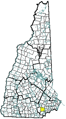 |
| Derry, NH |
| Community Contact |
Derry Planning Department
George H. Sioras, Community Development Director
14 Manning St
Derry, NH 03038
|
| Telephone |
(603) 432-6110 x5477 |
| Fax |
(603) 432-6109 |
| E-mail |
georgesioras@ci.derry.nh.us |
| Web Site |
www.derry-nh.org
|
| Municipal Office Hours |
Monday through Friday, 7 am - 4 pm; Town Clerk/Tax Collector: Monday, Tuesday, Thursday, Friday, 7 am - 4 pm, Wednesday, 10 am - 7 pm
|
| County |
Rockingham |
| Labor Market Area |
Nashua NH-MA NECTA Division, NH Portion |
| Tourism Region |
Merrimack Valley |
| Planning Commission |
Southern NH |
| Regional Development |
Rockingham Economic Development Corp.
|
| Election Districts |
|
|
US Congress
|
District 1 |
|
Executive Council
|
District 4 |
|
State Senate
|
District 19 |
|
State Representative
|
Rockingham County District 5 |
|
Incorporated: 1827
|
Origin: Although first settled in 1719, Derry was not incorporated until 1827. For over 100 years it was part of Londonderry, which also included all of Windham and portions of Manchester, Salem, and Hudson. The town was named for the Isle of Derry, Ireland, the Gaelic word Doire meaning "oak woods." Derry is the location of poet Robert Frost's homestead, which is listed on the National Register of Historic Sites, and the birthplace of both General John Stark and astronaut Alan Shepard. Two of the oldest private schools in America were founded here as well, Pinkerton Academy, founded in 1814 and still in operation, and the Adams Female Seminary.
|
Villages and Place Names: Chases Grove, Collettes Grove, Derry Village, East Derry, Howards Grove
|
Population, Year of the First Census Taken: 2,176 residents in 1830
|
Population Trends: Derry had the second largest numeric population change, totaling 28,286 over 50 years, from 5,826 in 1950 to 34,112 in 2000. The largest decennial percent change was 68 percent between 1960 and 1970, followed by decennial increases of 61 percent and 58 percent. The 2006 Census estimate for Derry was 34,103 residents, which ranked fourth among New Hampshire's incorporated cities and towns.
|
Population Density, 2006: 962.5 persons per square mile of land area, the ninth highest among the cities and towns. Derry contains 35.4 square miles of land area and 0.9 square miles of inland water area.
|
| Type of Government |
Town Admin./Council |
| Budget: Municipal Appropriations, 2007 |
$44,158,570 |
| Budget: School Appropriations, 2007 |
$71,418,981 |
| Zoning Ordinance |
1946/07 |
| Master Plan |
2002 |
| Capitol Improvement Plan |
Yes |
| Industrial Plans Reviewed By |
Planning Board |
| Boards and Commissions |
|
Elected:
|
Town Council |
|
Appointed:
|
Planning; Conservation; Zoning; Heritage |
| Public Library |
Derry Public; Taylor Library |
| Police Department |
Full-time |
| Fire Department |
Full-time |
| Town Fire Insurance Rating |
3/9 |
| Emergency Medical Service |
Full-time |
| Nearest Hospital(s) |
Distance |
Staffed Beds |
| Parkland Medical Center, Derry |
Local |
86 |
| |
|
|
| |
|
|
| Electric Supplier |
PSNH; NH Electric Coop; Granite State Electric |
| Natural Gas Supplier |
KeySpan |
| Water Supplier |
Derry Water Department |
| Sanitation |
Municipal |
| Municipal Wastewater Treatment Plant |
Yes |
| Solid Waste Disposal |
|
|
Curbside Trash Pickup
|
Private |
|
Pay-As-You-Throw Program
|
No |
|
Recycling
|
Mandatory |
| Telephone Company |
Verizon |
| Cellular Telephone Access |
Yes |
| Cable Television Access |
Yes |
| Public Access Television Station |
Yes |
| High Speed Internet Service: |
|
|
Business
|
Yes |
|
Residential
|
Yes |
|
|
| 2006 Total Tax Rate (per $1000 of value) |
$22.16 |
| 2006 Equalization Ratio |
94.7 |
| 2006 Full Value Tax Rate (per $1000 of value) |
$20.81 |
| 2006 Percent of Local Assessed Value by Property Type |
|
Residential Land and Buildings
|
84.0% |
|
Commercial Land and Buildings
|
15.3% |
|
Public Utilities, Current Use, and Other
|
0.7% |
|
|
| 2006 Total Housing Units |
13,239 |
| |
|
| 2006 Single-Family Units |
6,704 |
|
Single-Family Permits Issued, Net Change of Units
|
32 |
| 2006 Multi-Family Units |
5,962 |
|
Multi-Family Permits Issued, Net Change of Units
|
33 |
| 2006 Manufactured Housing Units |
573 |
|
|
 |
|
|
|
| Total Population |
Community |
County |
| 2006 |
34,103 |
296,267 |
| 2000 |
34,112 |
278,748 |
| 1990 |
29,745 |
246,744 |
| 1980 |
18,875 |
190,345 |
| 1970 |
11,712 |
138,951 |
| Census 2000 Demographics |
| Population by Gender |
|
Male
|
16,893 |
Female
|
17,128 |
| Population by Age Group |
|
Under age 5
|
2,436 |
|
Age 5 to 19
|
8,653 |
|
Age 20 to 34
|
6,809 |
|
Age 35 to 54
|
11,816 |
|
Age 55 to 64
|
2,204 |
|
Age 65 and over
|
2,103 |
|
Median Age
|
33.6 years |
| Educational Attainment, population 25 years and over |
|
High school graduate or higher
|
90.9% |
|
Bachelor's degree or higher
|
26.3% |
|
|
| Per capita income |
$22,315 |
| Median 4-person family income |
$61,625 |
| Median household income |
$54,634 |
| Median Earnings, full-time, year-round workers |
|
Male
|
$41,271 |
|
Female
|
$30,108 |
| Families below the poverty level |
3.3% |
|
|
| Annual Average |
1996 |
2006 |
|
Civilian Labor Force
|
18,802 |
20,275 |
|
Employed
|
17,960 |
19,459 |
|
Unemployed
|
842 |
816 |
|
Unemployment Rate
|
4.5% |
4.0% |
|
|
| Annual Average Covered Employment |
1996 |
2006 |
| Goods Producing Industries |
|
|
|
Average Employment
|
2,222 |
1,282 |
|
Average Weekly Wage
|
$603 |
$1,052 |
| |
|
|
| Service Providing Industries |
|
|
|
Average Employment
|
5,257 |
5,885 |
|
Average Weekly Wage
|
$441 |
$649 |
| |
|
|
| Total Private Industry |
|
|
|
Average Employment
|
7,479 |
7,167 |
|
Average Weekly Wage
|
$489 |
$721 |
| |
|
|
| Government (Federal, State, and Local) |
|
|
|
Average Employment
|
791 |
1,062 |
|
Average Weekly Wage
|
$593 |
$829 |
| |
|
|
| Total, Private plus Government |
|
|
|
Average Employment
|
8,270 |
8,229 |
|
Average Weekly Wage
|
$499 |
$735 |
| n = indicates that the data does not meet disclosure standards |
|
| Schools students attend: |
Derry operates grades 1-8; grades 9-12 are tuitioned to Pinkerton Academy (Derry) |
District: SAU 10 |
| Career Technology Center(s): |
Pinkerton Academy, Derry; Salem High School Vocational Center |
Region: 17 |
|
| |
| Educational Facilities |
Elementary |
Middle/Junior High |
High School |
Private/Parochial |
|
Number of Schools
|
6 |
2 |
1 |
3 |
|
Grade Levels
|
P 1-5 |
6-8 |
9-12 |
K 1-12 |
|
Total Enrollment
|
2,278 |
1,601 |
3,358 |
574 |
|
| NH Licensed Child Care Facilities, 2007: |
Total Facilities: 28 |
Total Capacity: 1,510 |
|
| Nearest Community/Technical College: Manchester; Nashua |
| Nearest Colleges or Universities: Chester College of New England; Hesser; Southern NH University; UNH-Manchester; St. Anselm |
|
| Derry Cooperative School System |
Education |
685 |
|
| HCA Health Services of NH |
Health care administration |
589 |
|
| Pinkerton Academy |
Education |
459 |
|
| Wal-mart |
Department store |
200 |
1992 |
| Shaw's Supermarket |
Supermarket |
180 |
1980 |
| Fireye |
Fire equipment |
150 |
1965 |
| Hannaford |
Supermarket |
150 |
2000 |
| Sanmina |
Painted circuit boards |
80 |
2007 |
| Vermillion |
Color separations |
72 |
1977 |
| Merrimack Valley Wood Products |
Door, window units |
70 |
1971 |
| Road Access |
US Routes |
|
| |
State Routes |
28, 102, 111, 121, 28 Bypass |
| Nearest Interstate, Exit |
I-93, Exit 4 |
| |
Distance |
1 mile |
| Railroad |
No |
| Public Transportation |
No |
| |
| Nearest Public Use Airport, General Aviation |
|
Manchester-Boston Regional
|
|
Runway
|
9,250 ft. asphalt |
|
Lighted?
|
Yes |
Navigational Aids? |
Yes |
| Nearest Airport with Scheduled Service |
| Manchester-Boston Regional |
Distance |
13 miles |
| Number of Passsenger Airlines Serving Airport |
8 |
| Driving distance to selected cities: |
|
Manchester, NH
|
13 miles |
|
Portland, ME
|
94 miles |
|
Boston, MA
|
43 miles |
|
New York City, NY
|
246 miles |
|
Montreal, Quebec
|
269 miles |
| Workers 16 years and over |
|
|
Drove alone, car/truck/van
|
84.9% |
|
Carpooled, car/truck/van
|
9.7% |
|
Public transportation
|
0.8% |
|
Walked
|
1.4% |
|
Other Means
|
0.6% |
|
Worked at home
|
2.7% |
| Mean Travel Time to Work |
31.1 minutes |
| |
|
| Percent of Working Residents: |
|
|
Working in community of residence
|
20% |
|
Commuting to another NH community
|
47% |
|
Commuting out-of-state
|
33% |
|
|
|
|
| X |
Municipal Parks |
| |
YMCA/YWCA |
| X |
Boys Club/Girls Club |
| X |
Golf Courses |
| X |
Swimming: Indoor Facility |
| |
Swimming: Outdoor Facility |
| |
Tennis Courts: Indoor Faclity |
| X |
Tennis Courts: Outdoor Facility |
| |
Ice Skating Rink: Indoor Facility |
| |
Bowling Facilities |
| X |
Museums |
| X |
Cinemas |
| X |
Performing Arts Facilities |
| X |
Tourists Attractions |
| X |
Youth Organizations (i.e., Scouts, 4-H) |
| X |
Youth Sports: Baseball |
| X |
Youth Sports: Soccer |
| X |
Youth Sports: Football |
| X |
Youth Sports: Basketball |
| X |
Youth Sports: Hockey |
| X |
Campgrounds |
| X |
Fishing/Hunting |
| X |
Boating/Marinas |
| X |
Snowmobile Trails |
| X |
Bicycle Trails |
| X |
Cross Country Skiing |
| X |
Beach or Waterfront Recreational Area |
| |
Overnight or Day Camps |
| |
|
| |
Nearest Ski Area(s): McIntyre |
| |
|
| |
Other: Beaver Lake w/ Public Beach; Robert Frost Homestead; Skateboard Park; Opera House; Metamorphosis Children's Museum; Hood Pond |
|
Economic & Labor Market Information Bureau, NH Employment Security, 2007. Community Response Received 08/17/07
|
|