Tinkham Realty, Inc.
3 McAllister Drive
Londonderry, NH 03053
(603) 432-7769
(603) 434-1545 Fax
info@tinkhamrealty.com
|
Hampstead, NH Town Profile
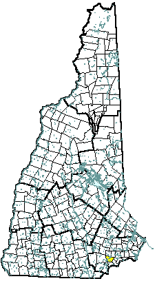 |
| Hampstead, NH |
| Community Contact |
Hampstead Board of Selectmen
Sally Theriault, Administrative Assistant
11 Main Street
Hampstead, NH 03841
|
| Telephone |
(603) 329-4100 x100 |
| Fax |
(603) 329-6628 |
| E-mail |
sallytheriault@comcast.net |
| Web Site |
www.hampsteadnh.us
|
| Municipal Office Hours |
Monday, 8 am - 7 pm; Tuesday, Wednesday, and Thursday, 8 am - 4 pm; and Friday, 8 am - 12 noon
|
| County |
Rockingham |
| Labor Market Area |
Haverhill MA-NH NECTA Division, NH Portion |
| Tourism Region |
Seacoast |
| Planning Commission |
Rockingham |
| Regional Development |
Rockingham Economic Development Corp.
|
| Election Districts |
|
|
US Congress
|
District 1 |
|
Executive Council
|
District 3 |
|
State Senate
|
District 19 |
|
State Representative
|
Rockingham County District 8 |
|
Incorporated: 1749
|
Origin: Hampstead began as a part of Haverhill and Amesbury, Massachusetts, and was formed as a result of the 1739 change in boundary lines between Massachusetts and the new province of New Hampshire. It was originally known as Timberlane Parish, because of the heavy growth of native trees. In 1749, residents of the area voted to petition the governor for incorporation. Governor Benning Wentworth named the town Hampstead, after the English town where William Pitt, Earl of Chatham, lived. Pitt, a close friend of Governor Wentworth, was Prime Minister of England, and a supporter of the American cause.
|
Villages and Place Names: East Hampstead, West Hampstead
|
Population, Year of the First Census Taken: 724 residents in 1790
|
Population Trends: Hampstead had the eighth highest 50-year percent population increase, growing over nine times larger. The largest decennial percent change was 90 percent between 1960 and 1970. Population change totaled 7,403, from 902 in 1950 to 8,305 in 2000. The 2006 Census estimate for Hampstead was 8,832 residents, which ranked 33rd among New Hampshire's incorporated cities and towns.
|
Population Density, 2006: 659.1 persons per square mile of land area. Hampstead contains 13.4 square miles of land area and 0.7 square miles of inland water area.
|
| Type of Government |
Selectmen |
| Budget: Municipal Appropriations, 2005 |
$4,118,830 |
| Budget: School Appropriations, 2005 |
$19,037,673 |
| Zoning Ordinance |
1952/05 |
| Master Plan |
1992 |
| Capitol Improvement Plan |
Yes |
| Industrial Plans Reviewed By |
Planning Board |
| Boards and Commissions |
|
Elected:
|
Selectmen; Planning; Library; Cemetery; Budget; School; Trust Funds |
|
Appointed:
|
Conservation; Zoning; Cable TV; Historic; Recreation; Solidwaste |
| Public Library |
Hampstead Public |
| Police Department |
Full-time |
| Fire Department |
Full-time |
| Town Fire Insurance Rating |
9 |
| Emergency Medical Service |
Municipal |
| Nearest Hospital(s) |
Distance |
Staffed Beds |
| Parkland Medical Center, Derry |
9 miles |
86 |
| |
|
|
| |
|
|
| Electric Supplier |
PSNH; Exeter & Hampton |
| Natural Gas Supplier |
None |
| Water Supplier |
Hampstead Area Water Co. |
| Sanitation |
Private septic |
| Municipal Wastewater Treatment Plant |
No |
| Solid Waste Disposal |
|
|
Curbside Trash Pickup
|
Municipal |
|
Pay-As-You-Throw Program
|
No |
|
Recycling
|
Voluntary |
| Telephone Company |
Verizon |
| Cellular Telephone Access |
Yes |
| Cable Television Access |
Yes |
| Public Access Television Station |
Yes |
| High Speed Internet Service: |
|
|
Business
|
Yes |
|
Residential
|
Yes |
|
|
| 2006 Total Tax Rate (per $1000 of value) |
$18.12 |
| 2006 Equalization Ratio |
87.1 |
| 2006 Full Value Tax Rate (per $1000 of value) |
$15.54 |
| 2006 Percent of Local Assessed Value by Property Type |
|
Residential Land and Buildings
|
90.4% |
|
Commercial Land and Buildings
|
9.1% |
|
Public Utilities, Current Use, and Other
|
0.4% |
|
|
| 2006 Total Housing Units |
3626 |
| |
|
| 2006 Single-Family Units |
2,556 |
|
Single-Family Permits Issued, Net Change of Units
|
8 |
| 2006 Multi-Family Units |
766 |
|
Multi-Family Permits Issued, Net Change of Units
|
42 |
| 2006 Manufactured Housing Units |
304 |
|
|
 |
|
|
|
| Total Population |
Community |
County |
| 2006 |
8,832 |
296,267 |
| 2000 |
8,305 |
278,748 |
| 1990 |
6,848 |
246,744 |
| 1980 |
3,785 |
190,345 |
| 1970 |
2,401 |
138,951 |
| Census 2000 Demographics |
| Population by Gender |
|
Male
|
4,116 |
Female
|
4,181 |
| Population by Age Group |
|
Under age 5
|
495 |
|
Age 5 to 19
|
2,054 |
|
Age 20 to 34
|
1,120 |
|
Age 35 to 54
|
3,086 |
|
Age 55 to 64
|
767 |
|
Age 65 and over
|
775 |
|
Median Age
|
38.1 years |
| Educational Attainment, population 25 years and over |
|
High school graduate or higher
|
93.3% |
|
Bachelor's degree or higher
|
36.3% |
|
|
| Per capita income |
$29,195 |
| Median 4-person family income |
$79,114 |
| Median household income |
$68,533 |
| Median Earnings, full-time, year-round workers |
|
Male
|
$56,625 |
|
Female
|
$31,449 |
| Families below the poverty level |
2.4% |
|
|
| Annual Average |
1996 |
2006 |
|
Civilian Labor Force
|
4,298 |
4,770 |
|
Employed
|
4,069 |
4,564 |
|
Unemployed
|
229 |
206 |
|
Unemployment Rate
|
5.3% |
4.3% |
|
|
| Annual Average Covered Employment |
1996 |
2006 |
| Goods Producing Industries |
|
|
|
Average Employment
|
509 |
496 |
|
Average Weekly Wage
|
$662 |
$785 |
| |
|
|
| Service Providing Industries |
|
|
|
Average Employment
|
1,008 |
1,600 |
|
Average Weekly Wage
|
$466 |
$620 |
| |
|
|
| Total Private Industry |
|
|
|
Average Employment
|
1,517 |
2,096 |
|
Average Weekly Wage
|
$532 |
$659 |
| |
|
|
| Government (Federal, State, and Local) |
|
|
|
Average Employment
|
86 |
93 |
|
Average Weekly Wage
|
$211 |
$428 |
| |
|
|
| Total, Private plus Government |
|
|
|
Average Employment
|
1,603 |
2,189 |
|
Average Weekly Wage
|
$514 |
$649 |
| n = indicates that the data does not meet disclosure standards |
|
| Schools students attend: |
Hampstead operates grades 1-8; grades 9-12 are tuitioned to Pinkerton Academy (Derry) |
District: SAU 55 |
| Career Technology Center(s): |
Pinkerton Academy, Derry; Salem High School Vocational Center |
Region: 17 |
|
| |
| Educational Facilities |
Elementary |
Middle/Junior High |
High School |
Private/Parochial |
|
Number of Schools
|
1 |
1 |
|
1 |
|
Grade Levels
|
P K 1-4 |
5-8 |
|
K 1-8 |
|
Total Enrollment
|
536 |
521 |
|
264 |
|
| NH Licensed Child Care Facilities, 2007: |
Total Facilities: 10 |
Total Capacity: 593 |
|
| Nearest Community/Technical College: Nashua; Manchester |
| Nearest Colleges or Universities: University of NH; McIntosh |
|
| Hampstead Hospital |
Psychiatric hospital |
130 |
1975 |
| Consolidated Plastechs |
Plastic injection moulding |
60 |
1966 |
| East Coast Lumber |
Lumber sales |
35 |
1976 |
| Hannaford |
Supermarket |
|
|
| |
|
|
|
| |
|
|
|
| |
|
|
|
| |
|
|
|
| |
|
|
|
| |
|
|
|
| Road Access |
US Routes |
|
| |
State Routes |
111, 121, 121A |
| Nearest Interstate, Exit |
I-93, Exit 3 |
| |
Distance |
8 miles |
| Railroad |
No |
| Public Transportation |
No |
| |
| Nearest Public Use Airport, General Aviation |
|
Lawrence (MA) Municipal
|
|
Runway
|
5,000 ft. asphalt |
|
Lighted?
|
Yes |
Navigational Aids? |
Yes |
| Nearest Airport with Scheduled Service |
| Manchester-Boston Regional |
Distance |
17 miles |
| Number of Passsenger Airlines Serving Airport |
8 |
| Driving distance to selected cities: |
|
Manchester, NH
|
20 miles |
|
Portland, ME
|
87 miles |
|
Boston, MA
|
43 miles |
|
New York City, NY
|
246 miles |
|
Montreal, Quebec
|
277 miles |
| Workers 16 years and over |
|
|
Drove alone, car/truck/van
|
88.6% |
|
Carpooled, car/truck/van
|
6.2% |
|
Public transportation
|
0.4% |
|
Walked
|
0.8% |
|
Other Means
|
0.2% |
|
Worked at home
|
3.8% |
| Mean Travel Time to Work |
32.9 minutes |
| |
|
| Percent of Working Residents: |
|
|
Working in community of residence
|
14% |
|
Commuting to another NH community
|
42% |
|
Commuting out-of-state
|
44% |
|
|
|
|
| X |
Municipal Parks |
| |
YMCA/YWCA |
| |
Boys Club/Girls Club |
| |
Golf Courses |
| |
Swimming: Indoor Facility |
| |
Swimming: Outdoor Facility |
| |
Tennis Courts: Indoor Faclity |
| X |
Tennis Courts: Outdoor Facility |
| |
Ice Skating Rink: Indoor Facility |
| |
Bowling Facilities |
| X |
Museums |
| |
Cinemas |
| |
Performing Arts Facilities |
| |
Tourists Attractions |
| X |
Youth Organizations (i.e., Scouts, 4-H) |
| X |
Youth Sports: Baseball |
| X |
Youth Sports: Soccer |
| X |
Youth Sports: Football |
| X |
Youth Sports: Basketball |
| |
Youth Sports: Hockey |
| X |
Campgrounds |
| |
Fishing/Hunting |
| |
Boating/Marinas |
| |
Snowmobile Trails |
| |
Bicycle Trails |
| |
Cross Country Skiing |
| X |
Beach or Waterfront Recreational Area |
| X |
Overnight or Day Camps |
| |
|
| |
Nearest Ski Area(s): McIntyre |
| |
|
| |
Other: Walking Trail System |
|
Economic & Labor Market Information Bureau, NH Employment Security, 2007. Community Response Received 08/22/07
|
|