Tinkham Realty, Inc.
3 McAllister Drive
Londonderry, NH 03053
(603) 432-7769
(603) 434-1545 Fax
info@tinkhamrealty.com
|
Merrimack, NH Town Profile
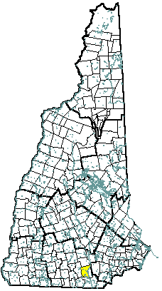 |
| Merrimack, NH |
| Community Contact |
Town of Merrimack
Walter Warren, Community Development Director
Town Office, PO Box 940
Merrimack, NH 03054
|
| Telephone |
(603) 424-3531 |
| Fax |
(603) 424-1408 |
| E-mail |
wwarren@ci.merrimack.nh.us |
| Web Site |
www.ci.merrimack.nh.us
|
| Municipal Office Hours |
Monday through Friday, 8:30 am - 4:30 pm
|
| County |
Hillsborough |
| Labor Market Area |
Nashua NH-MA NECTA Division, NH Portion |
| Tourism Region |
Merrimack Valley |
| Planning Commission |
Nashua Regional |
| Regional Development |
Gateway Industrial Development Corp.
|
| Election Districts |
|
|
US Congress
|
District 1 |
|
Executive Council
|
District 5 |
|
State Senate
|
District 9 |
|
State Representative
|
Hillsborough County District 19 |
|
Incorporated: 1746
|
Origin: This territory was part of the 1673 charter of Dunstable, a large Massachusetts grant that was divided nearly in half with the establishment of the New Hampshire-Massachusetts border in 1741. Though the first log cabin was built here about 1665, settlement did not begin until the 1720s. When the town was separated from Dunstable (Nashua) in 1746, it was incorporated as Merrimack, after the river. In 1766, a ferry concession was granted to Edward Lutwyche, to facilitate trade and traffic between Litchfield and Merrimack. In 1784, the ferry was granted to Revolutionary War patriot Matthew Thornton, an area still known as Thornton's Ferry. Matthew Thornton was a resident of Merrimack until his death in 1803.
|
Villages and Place Names: Reeds Ferry, Souhegan Village, South Merrimack, Thorntons Ferry
|
Population, Year of the First Census Taken: 819 residents in 1790
|
Population Trends: Merrimack ranked fifth in both numeric and percent of population increase over 50 years, growing over 13 times larger. Population change totaled 23,359, from 1,908 in 1950 to 25,267 in 2000. The largest decennial percent change was 188 percent between 1960 and 1970. The 2006 Census estimate for Merrimack was 26,613 residents, which ranked eighth among New Hampshire's incorporated cities and towns.
|
Population Density, 2006: 815.8 persons per square mile of land area. Merrimack contains 32.6 square miles of land area and 0.8 square miles of inland water area.
|
| Type of Government |
Selectmen/Town Manager |
| Budget: Municipal Appropriations, 2007 |
$25,548,851 |
| Budget: School Appropriations, 2006-2007 |
$57,334,325 |
| Zoning Ordinance |
1953/06 |
| Master Plan |
2002 |
| Capitol Improvement Plan |
Yes |
| Industrial Plans Reviewed By |
Planning Board |
| Boards and Commissions |
|
Elected:
|
Town Council; Library; Ethics; School |
|
Appointed:
|
Planning; Zoning; Parks & Recreation; Conservation; Heritage |
| Public Library |
Merrimack Public |
| Police Department |
Full-time |
| Fire Department |
Full-time |
| Town Fire Insurance Rating |
5/9 |
| Emergency Medical Service |
Municipal |
| Nearest Hospital(s) |
Distance |
Staffed Beds |
| Southern NH Medical Center, Nashua |
8 miles |
188 |
| St. Joseph Hospital, Nashua |
9 miles |
208 |
| Catholic Medical Center, Manchester |
10 miles |
330 |
| Electric Supplier |
PSNH |
| Natural Gas Supplier |
KeySpan |
| Water Supplier |
Pennichuck Water Works; Merrimack Village District |
| Sanitation |
Municipal |
| Municipal Wastewater Treatment Plant |
Yes |
| Solid Waste Disposal |
|
|
Curbside Trash Pickup
|
None |
|
Pay-As-You-Throw Program
|
No |
|
Recycling
|
Yes |
| Telephone Company |
Verizon |
| Cellular Telephone Access |
Yes |
| Cable Television Access |
Yes |
| Public Access Television Station |
Yes |
| High Speed Internet Service: |
|
|
Business
|
Yes |
|
Residential
|
Yes |
|
|
| 2006 Total Tax Rate (per $1000 of value) |
$17.46 |
| 2006 Equalization Ratio |
97.5 |
| 2006 Full Value Tax Rate (per $1000 of value) |
$16.88 |
| 2006 Percent of Local Assessed Value by Property Type |
|
Residential Land and Buildings
|
80.3% |
|
Commercial Land and Buildings
|
18.9% |
|
Public Utilities, Current Use, and Other
|
0.9% |
|
|
| 2006 Total Housing Units |
9,803 |
| |
|
| 2006 Single-Family Units |
6,912 |
|
Single-Family Permits Issued, Net Change of Units
|
26 |
| 2006 Multi-Family Units |
2,673 |
|
Multi-Family Permits Issued, Net Change of Units
|
59 |
| 2006 Manufactured Housing Units |
218 |
|
|
 |
|
|
|
| Total Population |
Community |
County |
| 2006 |
26,613 |
402,789 |
| 2000 |
25,267 |
382,384 |
| 1990 |
22,234 |
336,549 |
| 1980 |
15,406 |
276,608 |
| 1970 |
8,595 |
223,941 |
| Census 2000 Demographics |
| Population by Gender |
|
Male
|
12,514 |
Female
|
12,605 |
| Population by Age Group |
|
Under age 5
|
1,731 |
|
Age 5 to 19
|
6,110 |
|
Age 20 to 34
|
4,219 |
|
Age 35 to 54
|
9,183 |
|
Age 55 to 64
|
2,275 |
|
Age 65 and over
|
1,601 |
|
Median Age
|
36 years |
| Educational Attainment, population 25 years and over |
|
High school graduate or higher
|
92.9% |
|
Bachelor's degree or higher
|
35.0% |
|
|
| Per capita income |
$27,748 |
| Median 4-person family income |
$72,011 |
| Median household income |
$68,817 |
| Median Earnings, full-time, year-round workers |
|
Male
|
$51,725 |
|
Female
|
$31,528 |
| Families below the poverty level |
1.2% |
|
|
| Annual Average |
1996 |
2006 |
|
Civilian Labor Force
|
13,754 |
16,644 |
|
Employed
|
13,294 |
16,150 |
|
Unemployed
|
460 |
494 |
|
Unemployment Rate
|
3.3% |
3.0% |
|
|
| Annual Average Covered Employment |
1996 |
2006 |
| Goods Producing Industries |
|
|
|
Average Employment
|
4,845 |
3,355 |
|
Average Weekly Wage
|
$1,001 |
$1,421 |
| |
|
|
| Service Providing Industries |
|
|
|
Average Employment
|
4,692 |
12,201 |
|
Average Weekly Wage
|
$556 |
$1,353 |
| |
|
|
| Total Private Industry |
|
|
|
Average Employment
|
9,537 |
15,556 |
|
Average Weekly Wage
|
$782 |
$1,367 |
| |
|
|
| Government (Federal, State, and Local) |
|
|
|
Average Employment
|
848 |
1,157 |
|
Average Weekly Wage
|
$577 |
$711 |
| |
|
|
| Total, Private plus Government |
|
|
|
Average Employment
|
10,385 |
16,714 |
|
Average Weekly Wage
|
$766 |
$1,322 |
| n = indicates that the data does not meet disclosure standards |
|
| Schools students attend: |
Merrimack operates grades 1-12 |
District: SAU 26 |
| Career Technology Center(s): |
Wilbur Palmer Voc. Tech. Center, Hudson; Milford HS; Nashua HS North |
Region: 16 |
|
| |
| Educational Facilities |
Elementary |
Middle/Junior High |
High School |
Private/Parochial |
|
Number of Schools
|
4 |
1 |
1 |
3 |
|
Grade Levels
|
P K 1-6 |
7-8 |
9-12 |
K 1-12 |
|
Total Enrollment
|
2,309 |
789 |
1,608 |
309 |
|
| NH Licensed Child Care Facilities, 2007: |
Total Facilities: 18 |
Total Capacity: 1,057 |
|
| Nearest Community/Technical College: Nashua |
| Nearest Colleges or Universities: Thomas More; Rivier; St. Anselm; Daniel Webster; Hesser |
|
| Fidelity Investments |
Financial services |
6,000 |
1996 |
| PC Connections, Inc. |
Computer resale |
1,077 |
1998 |
| BAE Systems |
Defense systems |
816 |
1988 |
| Merrimack School District |
Education |
800 |
|
| Anheuser-Busch, Inc. |
Malt beverages |
531 |
1991 |
| Kollsman Instrument Company |
Electra optics |
500 |
1991 |
| Brookstone, Inc. |
Mail order marketer/retailer |
256 |
|
| St. Gobain |
PTFE coated fabrics |
253 |
1984 |
| Town of Merrimack |
Municipal services |
215 |
1746 |
| GT Solar, Inc. |
Equipment for photovoltaic & semiconductor industries |
150 |
1995 |
| Road Access |
US Routes |
3 |
| |
State Routes |
101A |
| Nearest Interstate, Exit |
Everett Tpk., Exit 11; I-293, Exit 3 |
| |
Distance |
2 miles; 7 miles |
| Railroad |
Boston & Maine |
| Public Transportation |
No |
| |
| Nearest Public Use Airport, General Aviation |
|
Boire Field, Nashua
|
|
Runway
|
5,501 ft. asphalt |
|
Lighted?
|
Yes |
Navigational Aids? |
Yes |
| Nearest Airport with Scheduled Service |
| Manchester-Boston Regional |
Distance |
10 miles |
| Number of Passsenger Airlines Serving Airport |
8 |
| Driving distance to selected cities: |
|
Manchester, NH
|
11 miles |
|
Portland, ME
|
105 miles |
|
Boston, MA
|
51 miles |
|
New York City, NY
|
242 miles |
|
Montreal, Quebec
|
269 miles |
| Workers 16 years and over |
|
|
Drove alone, car/truck/van
|
87.5% |
|
Carpooled, car/truck/van
|
7.8% |
|
Public transportation
|
0.2% |
|
Walked
|
0.5% |
|
Other Means
|
0.5% |
|
Worked at home
|
3.5% |
| Mean Travel Time to Work |
25.6 minutes |
| |
|
| Percent of Working Residents: |
|
|
Working in community of residence
|
24% |
|
Commuting to another NH community
|
61% |
|
Commuting out-of-state
|
16% |
|
|
|
|
| X |
Municipal Parks |
| X |
YMCA/YWCA |
| |
Boys Club/Girls Club |
| |
Golf Courses |
| X |
Swimming: Indoor Facility |
| X |
Swimming: Outdoor Facility |
| X |
Tennis Courts: Indoor Faclity |
| X |
Tennis Courts: Outdoor Facility |
| X |
Ice Skating Rink: Indoor Facility |
| X |
Bowling Facilities |
| |
Museums |
| X |
Cinemas |
| X |
Performing Arts Facilities |
| X |
Tourists Attractions |
| X |
Youth Organizations (i.e., Scouts, 4-H) |
| X |
Youth Sports: Baseball |
| X |
Youth Sports: Soccer |
| X |
Youth Sports: Football |
| X |
Youth Sports: Basketball |
| |
Youth Sports: Hockey |
| |
Campgrounds |
| X |
Fishing/Hunting |
| X |
Boating/Marinas |
| X |
Snowmobile Trails |
| X |
Bicycle Trails |
| X |
Cross Country Skiing |
| X |
Beach or Waterfront Recreational Area |
| |
Overnight or Day Camps |
| |
|
| |
Nearest Ski Area(s): McIntyre |
| |
|
| |
Other: Anheuser-Busch Tours |
|
Economic & Labor Market Information Bureau, NH Employment Security, 2007. Community Response Received 10/01/07
|
|