Tinkham Realty, Inc.
3 McAllister Drive
Londonderry, NH 03053
(603) 432-7769
(603) 434-1545 Fax
info@tinkhamrealty.com
|
Pelham, NH Town Profile
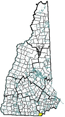 |
| Pelham, NH |
| Community Contact |
Pelham Planning Department
Jeff Gowan, Planning Director
6 Village Green
Pelham, NH 03076
|
| Telephone |
(603) 635-7811 |
| Fax |
(603) 635-6954 |
| E-mail |
planning@pelhamweb.com |
| Web Site |
www.pelhamweb.com
|
| Municipal Office Hours |
Monday through Friday, 8 am - 4 pm; Town Clerk: also Tuesday until 7 pm
|
| County |
Hillsborough |
| Labor Market Area |
Lowell MA-NH Micro-NECTA, NH Portion |
| Tourism Region |
Merrimack Valley |
| Planning Commission |
Nashua Regional |
| Regional Development |
Gateway Industrial Development Corp.
|
| Election Districts |
|
|
US Congress
|
District 2 |
|
Executive Council
|
District 4 |
|
State Senate
|
District 22 |
|
State Representative
|
Hillsborough County District 27 |
|
Incorporated: 1746
|
Origin: This territory was settled in 1722, when it was a part of Old Dunstable, which included all or part of what is now 12 towns in two states. When the New Hampshire-Massachusetts boundary line was set in 1741, Old Dunstable was split in half, with the northern half retaining the name Dunstable. Pelham was incorporated in 1746 from parts of Dunstable and Dracut, Massachusetts. The town takes its name from Henry Pelham, Prime Minister of England, a relation of Governor Benning Wentworth, and younger brother of Thomas Pelham-Holles.
|
Villages and Place Names: Pelham
|
Population, Year of the First Census Taken: 791 residents in 1790
|
Population Trends: Population change for Pelham totaled 9,689 over 50 years, from 1,317 in 1950 to 11,006 in 2000. The largest decennial percent change was a 108 percent increase between 1960 and 1970, which followed a 98 percent increase between 1950 and 1960. The 2006 Census estimate for Pelham was 12,514 residents, which ranked 24th among New Hampshire's incorporated cities and towns.
|
Population Density, 2006: 476.2 persons per square mile of land area. Pelham contains 26.3 square miles of land area and 0.5 square miles of inland water area.
|
| Type of Government |
Selectmen |
| Budget: Municipal Appropriations, 2007 |
$9,916,234 |
| Budget: School Appropriations, 2007 |
$22,550,134 |
| Zoning Ordinance |
1955/07 |
| Master Plan |
2002 |
| Capitol Improvement Plan |
Yes |
| Industrial Plans Reviewed By |
Stantec (consultant) |
| Boards and Commissions |
|
Elected:
|
Selectmen; Planning |
|
Appointed:
|
Conservation; Library; Cemetery; Zoning |
| Public Library |
Pelham Public |
| Police Department |
Full-time |
| Fire Department |
Full-time |
| Town Fire Insurance Rating |
9/10 |
| Emergency Medical Service |
Municipal |
| Nearest Hospital(s) |
Distance |
Staffed Beds |
| Saints Memorial Medical Ctr, Lowell MA |
7 miles |
150 |
| Lowell General, Lowell MA |
7 miles |
231 |
| Southern NH Medical Center, Nashua |
10 miles |
188 |
| Electric Supplier |
National Grid; PSNH |
| Natural Gas Supplier |
None |
| Water Supplier |
PEU/Williamsburg |
| Sanitation |
Private septic |
| Municipal Wastewater Treatment Plant |
No |
| Solid Waste Disposal |
|
|
Curbside Trash Pickup
|
None |
|
Pay-As-You-Throw Program
|
No |
|
Recycling
|
Mandatory |
| Telephone Company |
Verizon |
| Cellular Telephone Access |
Yes |
| Cable Television Access |
Yes |
| Public Access Television Station |
Yes |
| High Speed Internet Service: |
|
|
Business
|
Yes |
|
Residential
|
Yes |
|
|
| 2006 Total Tax Rate (per $1000 of value) |
$13.99 |
| 2006 Equalization Ratio |
100 |
| 2006 Full Value Tax Rate (per $1000 of value) |
$14.00 |
| 2006 Percent of Local Assessed Value by Property Type |
|
Residential Land and Buildings
|
93.1% |
|
Commercial Land and Buildings
|
5.0% |
|
Public Utilities, Current Use, and Other
|
1.9% |
|
|
| 2006 Total Housing Units |
4,411 |
| |
|
| 2006 Single-Family Units |
3,847 |
|
Single-Family Permits Issued, Net Change of Units
|
33 |
| 2006 Multi-Family Units |
537 |
|
Multi-Family Permits Issued, Net Change of Units
|
7 |
| 2006 Manufactured Housing Units |
27 |
|
|
 |
|
|
|
| Total Population |
Community |
County |
| 2006 |
12,514 |
402,789 |
| 2000 |
11,006 |
382,384 |
| 1990 |
9,428 |
336,549 |
| 1980 |
8,090 |
276,608 |
| 1970 |
5,408 |
223,941 |
| Census 2000 Demographics |
| Population by Gender |
|
Male
|
5,423 |
Female
|
5,491 |
| Population by Age Group |
|
Under age 5
|
804 |
|
Age 5 to 19
|
2,577 |
|
Age 20 to 34
|
1,824 |
|
Age 35 to 54
|
3,888 |
|
Age 55 to 64
|
967 |
|
Age 65 and over
|
854 |
|
Median Age
|
36 years |
| Educational Attainment, population 25 years and over |
|
High school graduate or higher
|
87.2% |
|
Bachelor's degree or higher
|
24.7% |
|
|
| Per capita income |
$25,158 |
| Median 4-person family income |
$73,365 |
| Median household income |
$68,608 |
| Median Earnings, full-time, year-round workers |
|
Male
|
$47,685 |
|
Female
|
$33,375 |
| Families below the poverty level |
1.6% |
|
|
| Annual Average |
1996 |
2006 |
|
Civilian Labor Force
|
6,105 |
7,132 |
|
Employed
|
5,773 |
6,789 |
|
Unemployed
|
332 |
343 |
|
Unemployment Rate
|
5.4% |
4.8% |
|
|
| Annual Average Covered Employment |
1996 |
2006 |
| Goods Producing Industries |
|
|
|
Average Employment
|
243 |
500 |
|
Average Weekly Wage
|
$516 |
$865 |
| |
|
|
| Service Providing Industries |
|
|
|
Average Employment
|
1,092 |
1,169 |
|
Average Weekly Wage
|
$367 |
$631 |
| |
|
|
| Total Private Industry |
|
|
|
Average Employment
|
1,335 |
1,669 |
|
Average Weekly Wage
|
$394 |
$701 |
| |
|
|
| Government (Federal, State, and Local) |
|
|
|
Average Employment
|
322 |
444 |
|
Average Weekly Wage
|
$517 |
$708 |
| |
|
|
| Total, Private plus Government |
|
|
|
Average Employment
|
1,658 |
2,113 |
|
Average Weekly Wage
|
$418 |
$702 |
| n = indicates that the data does not meet disclosure standards |
|
| Schools students attend: |
Pelham operates grades 1-12 |
District: SAU 28 |
| Career Technology Center(s): |
Pinkerton Academy, Derry; Salem High School Vocational Center |
Region: 17 |
|
| |
| Educational Facilities |
Elementary |
Middle/Junior High |
High School |
Private/Parochial |
|
Number of Schools
|
1 |
1 |
1 |
1 |
|
Grade Levels
|
R 1-5 |
6-8 |
9-12 |
K 1-8 |
|
Total Enrollment
|
925 |
533 |
705 |
237 |
|
| NH Licensed Child Care Facilities, 2007: |
Total Facilities: 14 |
Total Capacity: 728 |
|
| Nearest Community/Technical College: Nashua |
| Nearest Colleges or Universities: Daniel Webster; Rivier |
|
| National Northeast |
Aluminum extrusion |
300 |
1997 |
| Pelham School District |
Education |
258 |
|
| Hannaford Brothers |
Supermarket |
85 |
1996 |
| Quality Assured Cable |
Cabling |
70 |
1997 |
| Chunky's Cinema |
Cinema |
50 |
1997 |
| Yarde Metals |
Metal stock wholesaler |
25 |
|
| |
|
|
|
| |
|
|
|
| |
|
|
|
| |
|
|
|
| Road Access |
US Routes |
|
| |
State Routes |
38, 111A, 128 |
| Nearest Interstate, Exit |
I-93, Exits 1 - 2 |
| |
Distance |
6 miles |
| Railroad |
No |
| Public Transportation |
No |
| |
| Nearest Public Use Airport, General Aviation |
|
Boire Field, Nashua
|
|
Runway
|
5,501 ft. asphalt |
|
Lighted?
|
Yes |
Navigational Aids? |
Yes |
| Nearest Airport with Scheduled Service |
| Manchester-Boston Regional |
Distance |
25 miles |
| Number of Passsenger Airlines Serving Airport |
8 |
| Driving distance to selected cities: |
|
Manchester, NH
|
25 miles |
|
Portland, ME
|
97 miles |
|
Boston, MA
|
36 miles |
|
New York City, NY
|
231 miles |
|
Montreal, Quebec
|
282 miles |
| Workers 16 years and over |
|
|
Drove alone, car/truck/van
|
86.7% |
|
Carpooled, car/truck/van
|
8.3% |
|
Public transportation
|
1.0% |
|
Walked
|
0.7% |
|
Other Means
|
1.0% |
|
Worked at home
|
2.3% |
| Mean Travel Time to Work |
27.2 minutes |
| |
|
| Percent of Working Residents: |
|
|
Working in community of residence
|
14% |
|
Commuting to another NH community
|
31% |
|
Commuting out-of-state
|
55% |
|
|
|
|
| X |
Municipal Parks |
| |
YMCA/YWCA |
| |
Boys Club/Girls Club |
| X |
Golf Courses |
| |
Swimming: Indoor Facility |
| X |
Swimming: Outdoor Facility |
| |
Tennis Courts: Indoor Faclity |
| X |
Tennis Courts: Outdoor Facility |
| |
Ice Skating Rink: Indoor Facility |
| |
Bowling Facilities |
| |
Museums |
| X |
Cinemas |
| |
Performing Arts Facilities |
| |
Tourists Attractions |
| X |
Youth Organizations (i.e., Scouts, 4-H) |
| X |
Youth Sports: Baseball |
| X |
Youth Sports: Soccer |
| X |
Youth Sports: Football |
| X |
Youth Sports: Basketball |
| |
Youth Sports: Hockey |
| |
Campgrounds |
| X |
Fishing/Hunting |
| |
Boating/Marinas |
| X |
Snowmobile Trails |
| X |
Bicycle Trails |
| X |
Cross Country Skiing |
| X |
Beach or Waterfront Recreational Area |
| |
Overnight or Day Camps |
| |
|
| |
Nearest Ski Area(s): McIntyre |
| |
|
| |
Other: |
|
Economic & Labor Market Information Bureau, NH Employment Security, 2007. Community Response Received 10/02/07
|
|