Tinkham Realty, Inc.
3 McAllister Drive
Londonderry, NH 03053
(603) 432-7769
(603) 434-1545 Fax
info@tinkhamrealty.com
|
Raymond, NH Town Profile
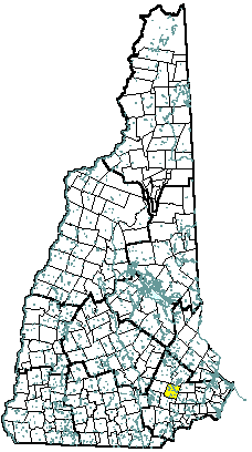 |
| Raymond, NH |
| Community Contact |
Raymond Town Office
Christopher Rose, Town Manager
4 Epping Street
Raymond, NH 03077
|
| Telephone |
(603) 895-4735 |
| Fax |
(603) 895-0903 |
| E-mail |
crose@townofraymondnh.com |
| Web Site |
www.raymond-nh.com
|
| Municipal Office Hours |
Monday through Friday, 8 am - 4:30 pm
|
| County |
Rockingham |
| Labor Market Area |
Nashua NH-MA NECTA Division, NH Portion |
| Tourism Region |
Merrimack Valley |
| Planning Commission |
Southern NH |
| Regional Development |
Rockingham Economic Development Corp.
|
| Election Districts |
|
|
US Congress
|
District 1 |
|
Executive Council
|
District 4 |
|
State Senate
|
District 17 |
|
State Representative
|
Rockingham County District 2 |
|
Incorporated: 1764
|
Origin: This territory was settled in 1717 by Colonel Stephen Dudley who claimed to have purchased the land from the Sagamore Indians. The township was called Freetown, because it was exempt from the usual obligation of reserving its tall pine trees for masts in the royal English Navy. In 1726, Freetown was included in the incorporation of Chester. It was separated from Chester in 1764, and renamed Raymond for Captain William Raymond, who had raised a company of soldiers to fight in the war against Canada. Land in Raymond was granted to soldiers from Beverly, Massachusetts, and it was also known as Beverly-Canada.
|
Villages and Place Names: Onway Lake
|
Population, Year of the First Census Taken: 727 residents in 1790
|
Population Trends: Population change for Raymond totaled 8,269 over 50 years, from 1,428 in 1950 to 9,697 in 2000. The largest decennial percent change was an 82 percent increase between 1970 and 1980; both the previous and next decade had a population change of over 60 percent. The 2006 Census estimate for Raymond was 10,188 residents, which ranked 28th among New Hampshire's incorporated cities and towns.
|
Population Density, 2006: 353.6 persons per square mile of land area. Raymond contains 28.8 square miles of land area and 0.8 square miles of inland water area.
|
| Type of Government |
Selectmen/Town Manager |
| Budget: Municipal Appropriations, 2006 |
$8,000,000 |
| Budget: School Appropriations |
not available |
| Zoning Ordinance |
1970/07 |
| Master Plan |
2002 |
| Capitol Improvement Plan |
Yes |
| Industrial Plans Reviewed By |
Planning Board |
| Boards and Commissions |
|
Elected:
|
Selectmen; School; Budget; Planning; Library; Ethics |
|
Appointed:
|
Zoning; Conservation; Cemetery; Historic District; Recreation; Solid Waste/Recycling; Highway Safety; Cable; CIP; Southern NH Planning; Business & Economic Development |
| Public Library |
Dudley-Tucker |
| Police Department |
Full-time |
| Fire Department |
Full-time |
| Town Fire Insurance Rating |
4/8B |
| Emergency Medical Service |
Volunteer |
| Nearest Hospital(s) |
Distance |
Staffed Beds |
| Exeter Hospital, Exeter |
14 miles |
100 |
| Elliot Hospital, Manchester |
16 miles |
296 |
| Parkland Medical Center, Derry |
16 miles |
86 |
| Electric Supplier |
PSNH; NH Electric Coop |
| Natural Gas Supplier |
None |
| Water Supplier |
Raymond Water Department |
| Sanitation |
Private septic |
| Municipal Wastewater Treatment Plant |
No |
| Solid Waste Disposal |
|
|
Curbside Trash Pickup
|
Municipal |
|
Pay-As-You-Throw Program
|
Yes |
|
Recycling
|
Voluntary |
| Telephone Company |
Verizon |
| Cellular Telephone Access |
Yes |
| Cable Television Access |
Yes |
| Public Access Television Station |
Yes |
| High Speed Internet Service: |
|
|
Business
|
Yes |
|
Residential
|
Yes |
|
|
| 2006 Total Tax Rate (per $1000 of value) |
$19.27 |
| 2006 Equalization Ratio |
97.9 |
| 2006 Full Value Tax Rate (per $1000 of value) |
$18.86 |
| 2006 Percent of Local Assessed Value by Property Type |
|
Residential Land and Buildings
|
86.6% |
|
Commercial Land and Buildings
|
11.8% |
|
Public Utilities, Current Use, and Other
|
1.6% |
|
|
| 2006 Total Housing Units |
4,305 |
| |
|
| 2006 Single-Family Units |
2,710 |
|
Single-Family Permits Issued, Net Change of Units
|
36 |
| 2006 Multi-Family Units |
909 |
|
Multi-Family Permits Issued, Net Change of Units
|
6 |
| 2006 Manufactured Housing Units |
686 |
|
|
 |
|
|
|
| Total Population |
Community |
County |
| 2006 |
10,188 |
296,267 |
| 2000 |
9,697 |
278,748 |
| 1990 |
8,854 |
246,744 |
| 1980 |
5,453 |
190,345 |
| 1970 |
3,003 |
138,951 |
| Census 2000 Demographics |
| Population by Gender |
|
Male
|
4,843 |
Female
|
4,831 |
| Population by Age Group |
|
Under age 5
|
680 |
|
Age 5 to 19
|
2,382 |
|
Age 20 to 34
|
1,866 |
|
Age 35 to 54
|
3,348 |
|
Age 55 to 64
|
728 |
|
Age 65 and over
|
670 |
|
Median Age
|
34.4 years |
| Educational Attainment, population 25 years and over |
|
High school graduate or higher
|
83.5% |
|
Bachelor's degree or higher
|
13.0% |
|
|
| Per capita income |
$18,430 |
| Median 4-person family income |
$50,889 |
| Median household income |
$48,829 |
| Median Earnings, full-time, year-round workers |
|
Male
|
$35,493 |
|
Female
|
$26,778 |
| Families below the poverty level |
5.3% |
|
|
| Annual Average |
1996 |
2006 |
|
Civilian Labor Force
|
5,175 |
6,062 |
|
Employed
|
4,901 |
5,826 |
|
Unemployed
|
274 |
236 |
|
Unemployment Rate
|
5.3% |
3.9% |
|
|
| Annual Average Covered Employment |
1996 |
2006 |
| Goods Producing Industries |
|
|
|
Average Employment
|
407 |
456 |
|
Average Weekly Wage
|
$649 |
$1,049 |
| |
|
|
| Service Providing Industries |
|
|
|
Average Employment
|
912 |
2,159 |
|
Average Weekly Wage
|
$310 |
$640 |
| |
|
|
| Total Private Industry |
|
|
|
Average Employment
|
1,319 |
2,615 |
|
Average Weekly Wage
|
$415 |
$712 |
| |
|
|
| Government (Federal, State, and Local) |
|
|
|
Average Employment
|
363 |
400 |
|
Average Weekly Wage
|
$432 |
$650 |
| |
|
|
| Total, Private plus Government |
|
|
|
Average Employment
|
1,682 |
3,014 |
|
Average Weekly Wage
|
$419 |
$704 |
| n = indicates that the data does not meet disclosure standards |
|
| Schools students attend: |
Raymond operates grades 1-12 |
District: SAU 33 |
| Career Technology Center(s): |
Seacoast School of Technology, Exeter |
Region: 18 |
|
| |
| Educational Facilities |
Elementary |
Middle/Junior High |
High School |
Private/Parochial |
|
Number of Schools
|
1 |
1 |
1 |
|
|
Grade Levels
|
P K 1-4 |
5-8 |
9-12 |
|
|
Total Enrollment
|
607 |
422 |
541 |
|
|
| NH Licensed Child Care Facilities, 2007: |
Total Facilities: 6 |
Total Capacity: 149 |
|
| Nearest Community/Technical College: Stratham; Manchester |
| Nearest Colleges or Universities: Chester College of New England; Hesser; Southern NH University; UNH-Manchester |
|
| Wal-Mart |
Distribution warehouse |
600 |
1995 |
| Hannaford Brothers |
Supermarket |
150 |
1989 |
| Ben Franklin/Ace Hardware |
Retail store |
63 |
1975 |
| Gemini Valve |
Ball valves |
60 |
1970 |
| Profile Metal Forming |
Metal forming, stamping |
40 |
1988 |
| Rehrig Pacific |
Plastic crates, trays |
30 |
1975 |
| Hampton Machine |
Machinery for leather industry |
28 |
1985 |
| Jackson Lumber & Millwork |
Lumber & custom millwork |
28 |
2003 |
| Aggregate Industries |
Mining, construction aggregate |
25 |
1986 |
| Shookus Machine |
Metal working |
13 |
1990 |
| Road Access |
US Routes |
|
| |
State Routes |
27, 101, 102, 107, 156 |
| Nearest Interstate, Exit |
I-93, Exit 7 |
| |
Distance |
15 miles |
| Railroad |
No |
| Public Transportation |
No |
| |
| Nearest Public Use Airport, General Aviation |
|
Manchester-Boston Regional
|
|
Runway
|
9,250 ft. asphalt |
|
Lighted?
|
Yes |
Navigational Aids? |
Yes |
| Nearest Airport with Scheduled Service |
| Manchester-Boston Regional |
Distance |
21 miles |
| Number of Passsenger Airlines Serving Airport |
8 |
| Driving distance to selected cities: |
|
Manchester, NH
|
17 miles |
|
Portland, ME
|
80 miles |
|
Boston, MA
|
64 miles |
|
New York City, NY
|
268 miles |
|
Montreal, Quebec
|
272 miles |
| Workers 16 years and over |
|
|
Drove alone, car/truck/van
|
83.7% |
|
Carpooled, car/truck/van
|
12.3% |
|
Public transportation
|
0.2% |
|
Walked
|
1.5% |
|
Other Means
|
0.2% |
|
Worked at home
|
1.9% |
| Mean Travel Time to Work |
31.6 minutes |
| |
|
| Percent of Working Residents: |
|
|
Working in community of residence
|
18% |
|
Commuting to another NH community
|
64% |
|
Commuting out-of-state
|
19% |
|
|
|
|
| X |
Municipal Parks |
| |
YMCA/YWCA |
| |
Boys Club/Girls Club |
| |
Golf Courses |
| |
Swimming: Indoor Facility |
| |
Swimming: Outdoor Facility |
| |
Tennis Courts: Indoor Faclity |
| X |
Tennis Courts: Outdoor Facility |
| |
Ice Skating Rink: Indoor Facility |
| X |
Bowling Facilities |
| |
Museums |
| |
Cinemas |
| |
Performing Arts Facilities |
| |
Tourists Attractions |
| X |
Youth Organizations (i.e., Scouts, 4-H) |
| X |
Youth Sports: Baseball |
| X |
Youth Sports: Soccer |
| X |
Youth Sports: Football |
| X |
Youth Sports: Basketball |
| |
Youth Sports: Hockey |
| X |
Campgrounds |
| X |
Fishing/Hunting |
| X |
Boating/Marinas |
| X |
Snowmobile Trails |
| X |
Bicycle Trails |
| X |
Cross Country Skiing |
| X |
Beach or Waterfront Recreational Area |
| |
Overnight or Day Camps |
| |
|
| |
Nearest Ski Area(s): McIntyre |
| |
|
| |
Other: Skateboarding; Pawtuckaway State Park; Town Beach w/lifeguards |
|
Economic & Labor Market Information Bureau, NH Employment Security, 2007. Community Response Received 08/09/07
|
|