Tinkham Realty, Inc.
3 McAllister Drive
Londonderry, NH 03053
(603) 432-7769
(603) 434-1545 Fax
info@tinkhamrealty.com
|
Salem, NH Town Profile
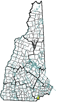 |
| Salem, NH |
| Community Contact |
Salem Planning Department
Ross Moldoff, Planning Director
33 Geremonty Drive
Salem, NH 03079
|
| Telephone |
(603) 890-2080 |
| Fax |
(603) 898-1223 |
| E-mail |
rmoldoff@ci.salem.nh.us |
| Web Site |
www.townofsalemnh.org
|
| Municipal Office Hours |
Monday through Friday, 8:30 am - 5 pm
|
| County |
Rockingham |
| Labor Market Area |
Lawrence MA-NH NECTA Division, NH Portion |
| Tourism Region |
Merrimack Valley |
| Planning Commission |
Rockingham |
| Regional Development |
Rockingham Economic Development Corp.
|
| Election Districts |
|
|
US Congress
|
District 2 |
|
Executive Council
|
District 3 |
|
State Senate
|
District 22 |
|
State Representative
|
Rockingham County District 4 |
|
Incorporated: 1750
|
Origin: This town was known as the North Parish of Methuen, Massachusetts, or Methuen District, a name used as early as 1736. In 1741, when the boundary line between Massachusetts and New Hampshire was established, the North Parish along with a portion of Dracut became part of New Hampshire, and named Salem, after nearby Salem, Massachusetts. The area was organized as a district without township privileges. Residents petitioned for a separate incorporation five different times before Governor Benning Wentworth chartered Salem as a town in 1750.
|
Villages and Place Names: Arlington Park, Canobie Lake, Cluffs Crossing, Cowbell Corners, Foster Corners, Hampshire Road, Millville, North Salem, Noyes Terrace, Pine Grove Park, Salem Depot, Wilson Corners, Mount Ararat
|
Population, Year of the First Census Taken: 1,218 residents in 1790
|
Population Trends: Population change for Salem totaled 23,414 over 50 years, the fourth largest numeric change, from 4,805 in 1950 to 28,219 in 2000. The largest decennial percent change was 119 percent between 1960 and 1970, this followed a 92 percent increase between 1950 and 1960. The 2006 Census estimate for Salem was 29,580 residents, which ranked sixth among New Hampshire's incorporated cities and towns.
|
Population Density, 2006: 1,192.7 persons per square mile of land area, the sixth highest among the cities and towns. Salem contains 24.8 square miles of land area and 1.1 square miles of inland water area.
|
| Type of Government |
Selectmen/Town Manager |
| Budget: Municipal Appropriations, 2006 |
$34,837,418 |
| Budget: School Appropriations, 2005 |
$45,500,000 |
| Zoning Ordinance |
1962/06 |
| Master Plan |
2001 |
| Capitol Improvement Plan |
Yes |
| Industrial Plans Reviewed By |
Planning Director |
| Boards and Commissions |
|
Elected:
|
Selectmen; Planning |
|
Appointed:
|
Zoning; Conservation |
| Police Department |
Full-time |
| Fire Department |
Full-time |
| Town Fire Insurance Rating |
5/9 |
| Emergency Medical Service |
Municipal |
| Nearest Hospital(s) |
Distance |
Staffed Beds |
| Holy Family Hospital, Methuen MA |
5 miles |
249 |
| Parkland Medical Center, Derry |
13 miles |
86 |
| |
|
|
| Electric Supplier |
National Grid |
| Natural Gas Supplier |
Northern Utilities |
| Water Supplier |
Salem Water Dept. |
| Sanitation |
Municipal |
| Municipal Wastewater Treatment Plant |
No |
| Solid Waste Disposal |
|
|
Curbside Trash Pickup
|
Private |
|
Pay-As-You-Throw Program
|
No |
|
Recycling
|
Mandatory |
| Telephone Company |
Verizon |
| Cellular Telephone Access |
Yes |
| Cable Television Access |
Yes |
| Public Access Television Station |
Yes |
| High Speed Internet Service: |
|
|
Business
|
Yes |
|
Residential
|
Yes |
|
|
| 2006 Total Tax Rate (per $1000 of value) |
$12.62 |
| 2006 Equalization Ratio |
97.7 |
| 2006 Full Value Tax Rate (per $1000 of value) |
$12.26 |
| 2006 Percent of Local Assessed Value by Property Type |
|
Residential Land and Buildings
|
72.9% |
|
Commercial Land and Buildings
|
26.3% |
|
Public Utilities, Current Use, and Other
|
0.7% |
|
|
| 2006 Total Housing Units |
12,068 |
| |
|
| 2006 Single-Family Units |
8,149 |
|
Single-Family Permits Issued, Net Change of Units
|
31 |
| 2006 Multi-Family Units |
3,024 |
|
Multi-Family Permits Issued, Net Change of Units
|
8 |
| 2006 Manufactured Housing Units |
895 |
|
|
 |
|
|
|
| Total Population |
Community |
County |
| 2006 |
29,580 |
296,267 |
| 2000 |
28,219 |
278,748 |
| 1990 |
25,841 |
246,744 |
| 1980 |
24,124 |
190,345 |
| 1970 |
20,142 |
138,951 |
| Census 2000 Demographics |
| Population by Gender |
|
Male
|
13,994 |
Female
|
14,118 |
| Population by Age Group |
|
Under age 5
|
1,783 |
|
Age 5 to 19
|
5,887 |
|
Age 20 to 34
|
4,749 |
|
Age 35 to 54
|
9,584 |
|
Age 55 to 64
|
2,869 |
|
Age 65 and over
|
3,240 |
|
Median Age
|
38.1 years |
| Educational Attainment, population 25 years and over |
|
High school graduate or higher
|
87.7% |
|
Bachelor's degree or higher
|
25.4% |
|
|
| Per capita income |
$26,170 |
| Median 4-person family income |
$67,278 |
| Median household income |
$58,090 |
| Median Earnings, full-time, year-round workers |
|
Male
|
$46,330 |
|
Female
|
$31,031 |
| Families below the poverty level |
3.1% |
|
|
| Annual Average |
1996 |
2006 |
|
Civilian Labor Force
|
16,536 |
17,550 |
|
Employed
|
15,474 |
16,704 |
|
Unemployed
|
1,062 |
846 |
|
Unemployment Rate
|
6.4% |
4.8% |
|
|
| Annual Average Covered Employment |
1996 |
2006 |
| Goods Producing Industries |
|
|
|
Average Employment
|
3,290 |
2,957 |
|
Average Weekly Wage
|
$799 |
$1,157 |
| |
|
|
| Service Providing Industries |
|
|
|
Average Employment
|
14,950 |
16,644 |
|
Average Weekly Wage
|
$467 |
$662 |
| |
|
|
| Total Private Industry |
|
|
|
Average Employment
|
18,240 |
19,601 |
|
Average Weekly Wage
|
$527 |
$737 |
| |
|
|
| Government (Federal, State, and Local) |
|
|
|
Average Employment
|
975 |
1,185 |
|
Average Weekly Wage
|
$647 |
$856 |
| |
|
|
| Total, Private plus Government |
|
|
|
Average Employment
|
19,215 |
20,786 |
|
Average Weekly Wage
|
$533 |
$744 |
| n = indicates that the data does not meet disclosure standards |
|
| Schools students attend: |
Salem operates grades 1-12 |
District: SAU 57 |
| Career Technology Center(s): |
Pinkerton Academy, Derry; Salem High School Vocational Center |
Region: 17 |
|
| |
| Educational Facilities |
Elementary |
Middle/Junior High |
High School |
Private/Parochial |
|
Number of Schools
|
6 |
1 |
1 |
3 |
|
Grade Levels
|
P 1-5 |
6-8 |
9-12 |
K 1-8 |
|
Total Enrollment
|
1,812 |
1,167 |
2,276 |
539 |
|
| NH Licensed Child Care Facilities, 2007: |
Total Facilities: 27 |
Total Capacity: 956 |
|
| Nearest Community/Technical College: Nashua |
| Nearest Colleges or Universities: Chester College of New England |
|
| Northeast Rehabilitation Hospital |
Comprehensive physical rehab |
300 |
1981 |
| JC Penney Co., Inc. |
Retail department store |
200 |
1991 |
| Key Packaging Industries Corporation |
High density polyethylene |
190 |
1986 |
| Reliable Security Guard Agency |
Security guard services |
135 |
1986 |
| Salem Haven, Inc. |
Elderly home |
120 |
1955 |
| The Home Depot |
Building supply |
100 |
1992 |
| |
|
|
|
| |
|
|
|
| |
|
|
|
| |
|
|
|
| Road Access |
US Routes |
|
| |
State Routes |
28, 38, 97, 111 |
| Nearest Interstate, Exit |
I-93, Exits 1 - 2 |
| |
Distance |
Local access |
| Railroad |
Boston & Maine |
| Public Transportation |
No |
| |
| Nearest Public Use Airport, General Aviation |
|
Lawrence (MA) Municipal
|
|
Runway
|
5,000 ft. asphalt |
|
Lighted?
|
Yes |
Navigational Aids? |
Yes |
| Nearest Airport with Scheduled Service |
| Manchester-Boston Regional |
Distance |
24 miles |
| Number of Passsenger Airlines Serving Airport |
8 |
| Driving distance to selected cities: |
|
Manchester, NH
|
23 miles |
|
Portland, ME
|
87 miles |
|
Boston, MA
|
33 miles |
|
New York City, NY
|
236 miles |
|
Montreal, Quebec
|
279 miles |
| Workers 16 years and over |
|
|
Drove alone, car/truck/van
|
88.8% |
|
Carpooled, car/truck/van
|
6.9% |
|
Public transportation
|
0.2% |
|
Walked
|
1.0% |
|
Other Means
|
0.9% |
|
Worked at home
|
2.3% |
| Mean Travel Time to Work |
26.4 minutes |
| |
|
| Percent of Working Residents: |
|
|
Working in community of residence
|
30% |
|
Commuting to another NH community
|
18% |
|
Commuting out-of-state
|
51% |
|
|
|
|
| X |
Municipal Parks |
| |
YMCA/YWCA |
| X |
Boys Club/Girls Club |
| X |
Golf Courses |
| X |
Swimming: Indoor Facility |
| |
Swimming: Outdoor Facility |
| |
Tennis Courts: Indoor Faclity |
| X |
Tennis Courts: Outdoor Facility |
| X |
Ice Skating Rink: Indoor Facility |
| X |
Bowling Facilities |
| X |
Museums |
| |
Cinemas |
| |
Performing Arts Facilities |
| X |
Tourists Attractions |
| X |
Youth Organizations (i.e., Scouts, 4-H) |
| X |
Youth Sports: Baseball |
| X |
Youth Sports: Soccer |
| X |
Youth Sports: Football |
| X |
Youth Sports: Basketball |
| X |
Youth Sports: Hockey |
| |
Campgrounds |
| X |
Fishing/Hunting |
| X |
Boating/Marinas |
| X |
Snowmobile Trails |
| |
Bicycle Trails |
| X |
Cross Country Skiing |
| X |
Beach or Waterfront Recreational Area |
| X |
Overnight or Day Camps |
| |
|
| |
Nearest Ski Area(s): McIntyre |
| |
|
| |
Other: Rockingham Park; Canobie Lake Park; Salem Town Forest; America's Stonehenge |
|
Economic & Labor Market Information Bureau, NH Employment Security, 2007. Community Response Received 08/20/07
|
|